
Crop maps
ImagineS proposes a new method for mapping crop types along the season by combining information coming from Sentinel-1, -2 and -3 proxy imagery. The objectie is to derive reliable (accuracy target set at 85%) crop maps as soon in the season as possible capitalizing on the advantage of each sensor: teh remporal coverage of Sentinel-3, the high spatial resolution of Sentinel-2 and the weather independent acquisitions of Sentinel-1. The details of the classification algorithm are given in the ATBD.
The crop maps products consist in three products:
- a Pre-seasonal Cropland Layer (PCL) map derived at the beginning of the growing season
- a Crop Group Layer (CGL) map discriminating winter crops derived at the end of the winter
- a high resolution Crop Type Layer (CTL) map updated at every acquisition along the season
The crop maps are available after registration. A Product User Manual describes their technical properties.
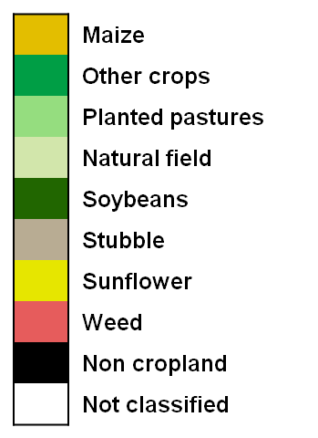
The crop maps products are distributed in .zip archives containing the one PCL map, one CGL map and multiple CTL maps at different dates in GEOTIFF files, and three csv files providing the respective legends of the maps. The crop maps of 2013 are available over the Tula Oblast, Russia, and for the Free State Province, South Africa.
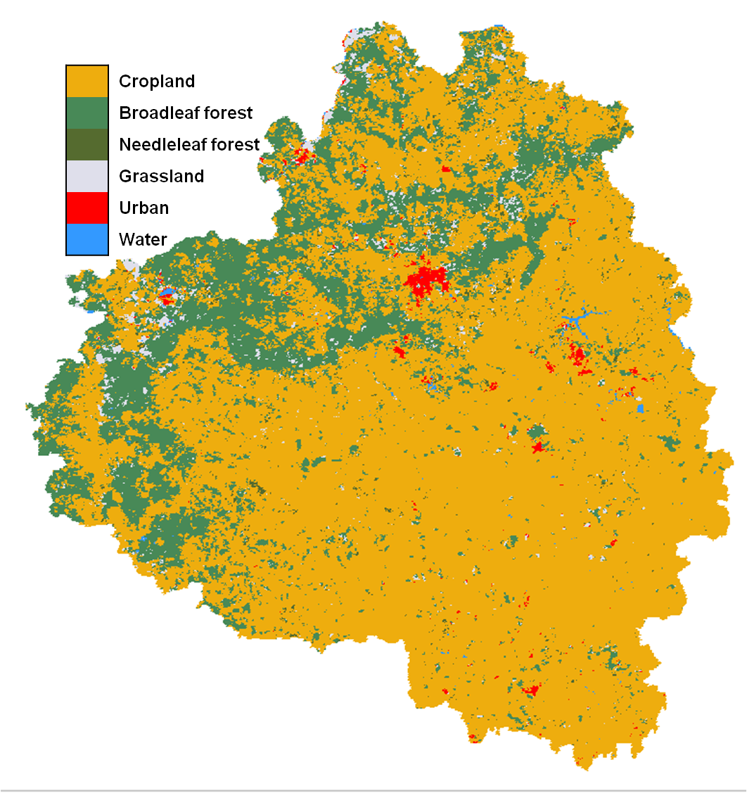
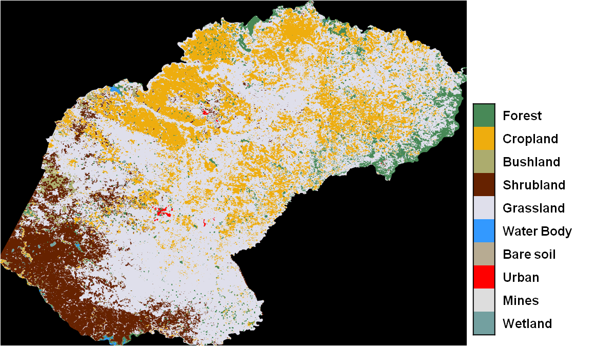
Pre-seasonal Crop map over Tula (Russia), September 2012 (left) and over Free State Province (South Africa) July 2013 (right)
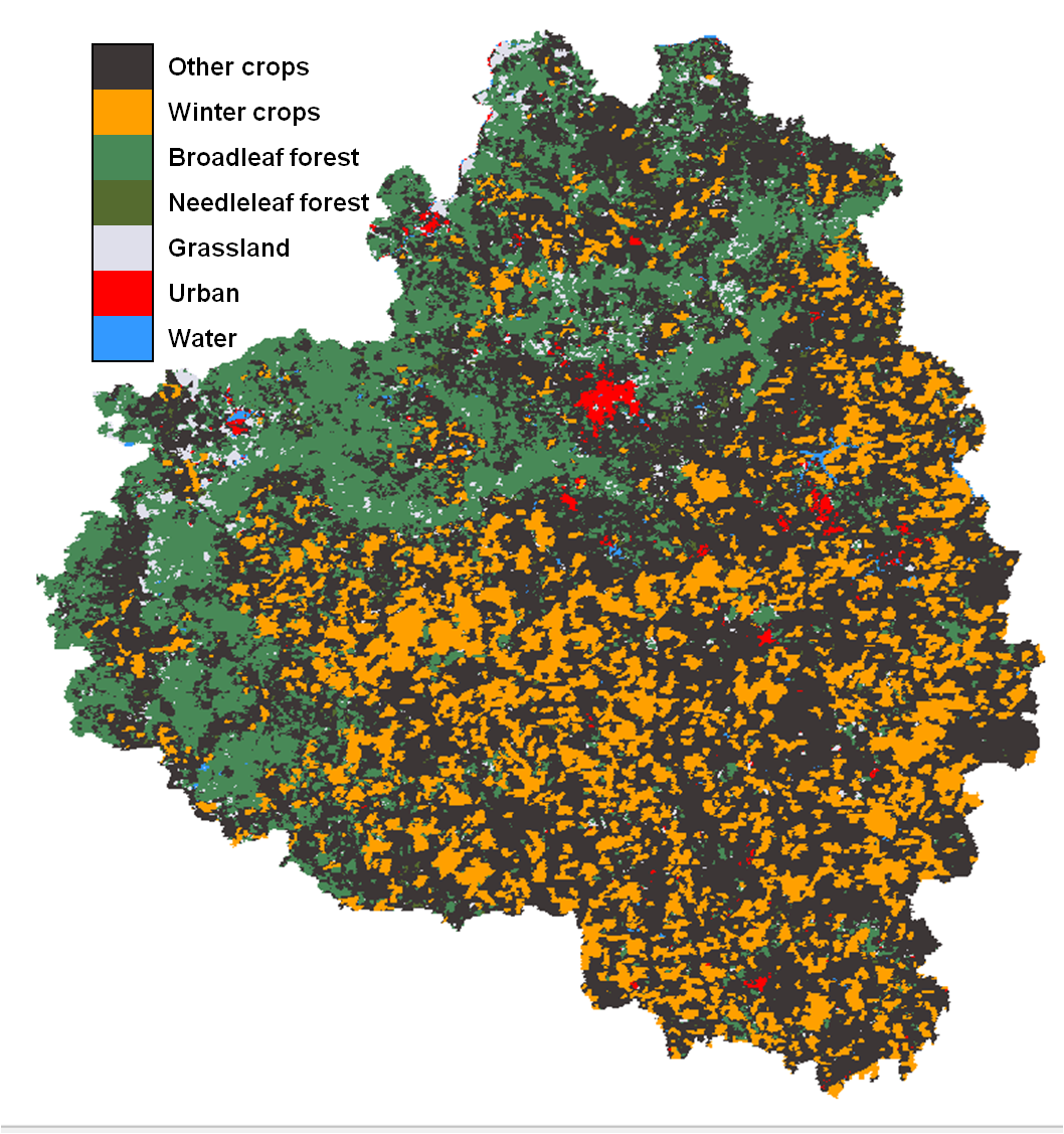
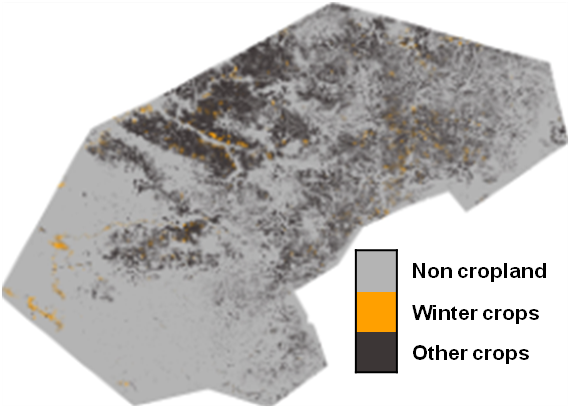
Crop Group map, April 2013 over Tula, Russia (left) and over the Free State Province, South Africa, November 2013 (right).
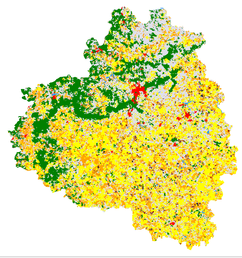
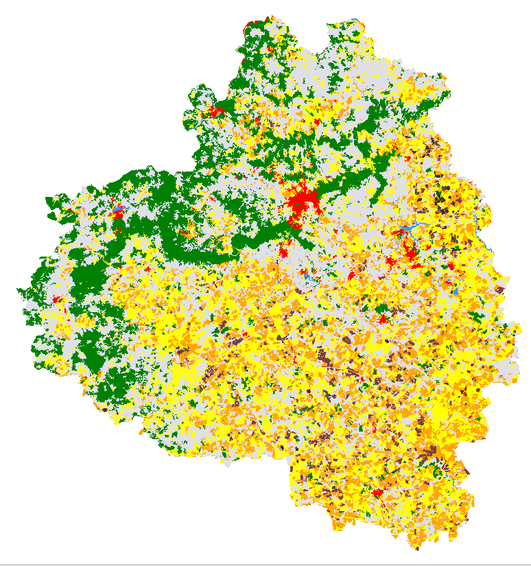
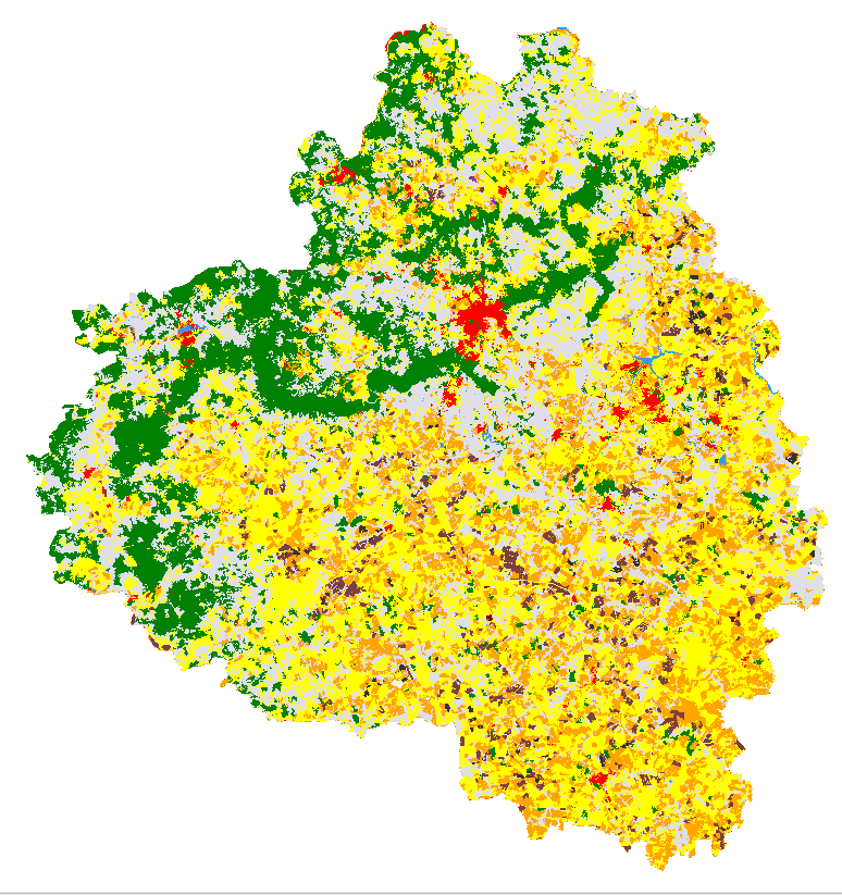
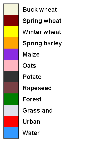
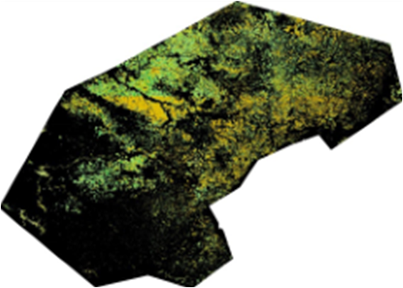
Crop Type maps in April, June and August 2013 over Tula Oblast.
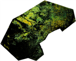
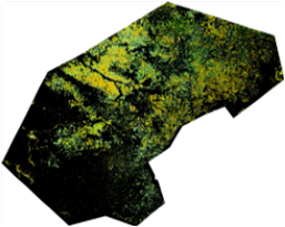
Crop Type maps in August 2013, December 2013 and March 2014 over Free State Province.