
Landsat-8 biophysical products
|
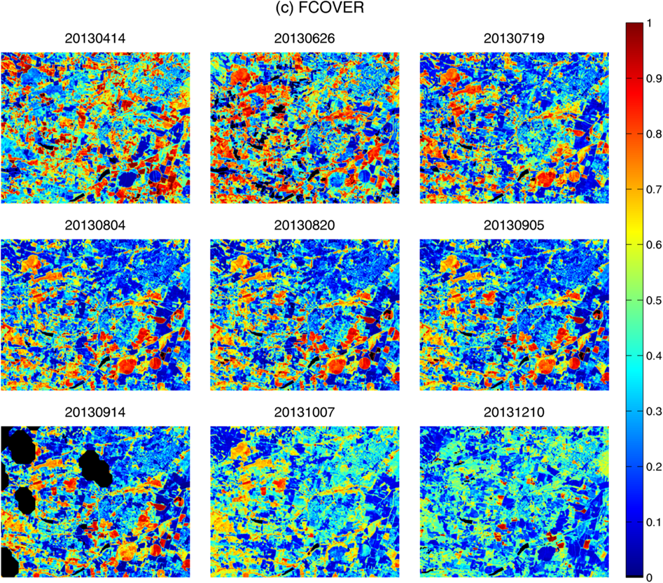
ImagineS provides biophysical variables (LAI, FAPAR and FCover) at 30m resolution derived from Landsat-8 time series of surface reflectances over 8 ImagineS demonstration sites (SouthWest in France, Barrax and La Albufera in Spain, Tana in Kenya, Ottawa in Canada, 25deMayo in Argentina, Rosasco in Italy and Pshenichne in Ukraine). The variables are estimated using artificial neural networks trained on PROSAIL model simulations. The retrieval methodology, set-up by INRA, is described in details in the ATBD.
The Landsat-8 products are available on the ImagineS ftp: you can get the access information after registration. A Product User Manual describes their technical characteristics, and presents the results of the quality assessment.
Maps of Landsat-8 FCover over SouthWest of France site |
 |
|
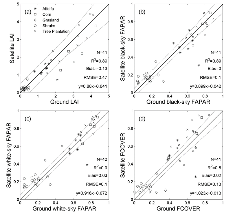
The high resolution Landsat-8 biophysical products are provided in multi-band GEOTIFF files which contain the variable (LAI, or Black-Sky FAPAR, or White-Sky FAPAR, or FCover), its associated uncertainty and a quality flag. The length of the time series depends on the demonstration site but it covers, at least, one growing season during the 2013-2014 period. The products are evaluated against the in-situ measurements collected over the demonstration sites.
Comparison of Landsat-8 products with ground measurements collected over 25deMayo site (Argentina) |
 |
A classification map has been set-up over the Sout-West area using a random forest classifier trained with in-situ observation and the Landsat-8 time series of surface reflectance as input. It was overlapped over each high resolution FAPAR map and an average FAPAR value has been calculated for each crop (wheat, rapeseed, corn, barley, soybean, sorgum, sunflower) and grassland over the year 2014.
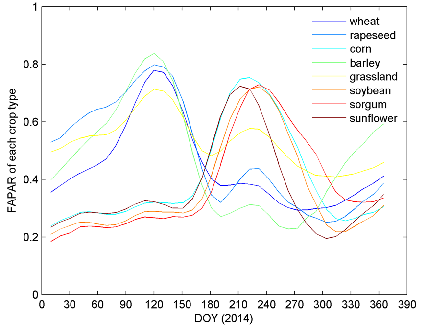
Seasonal variation of FAPAR per crop type over South-West area in 2014.